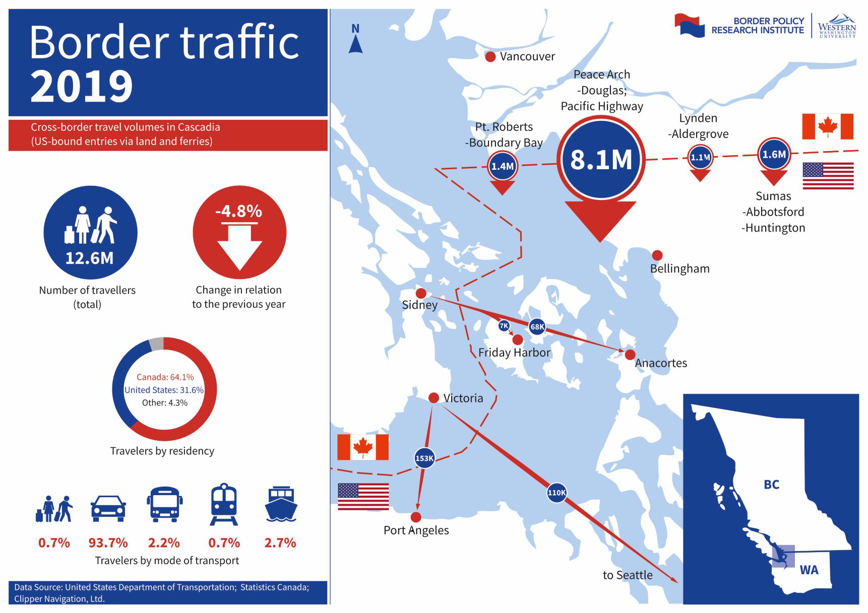
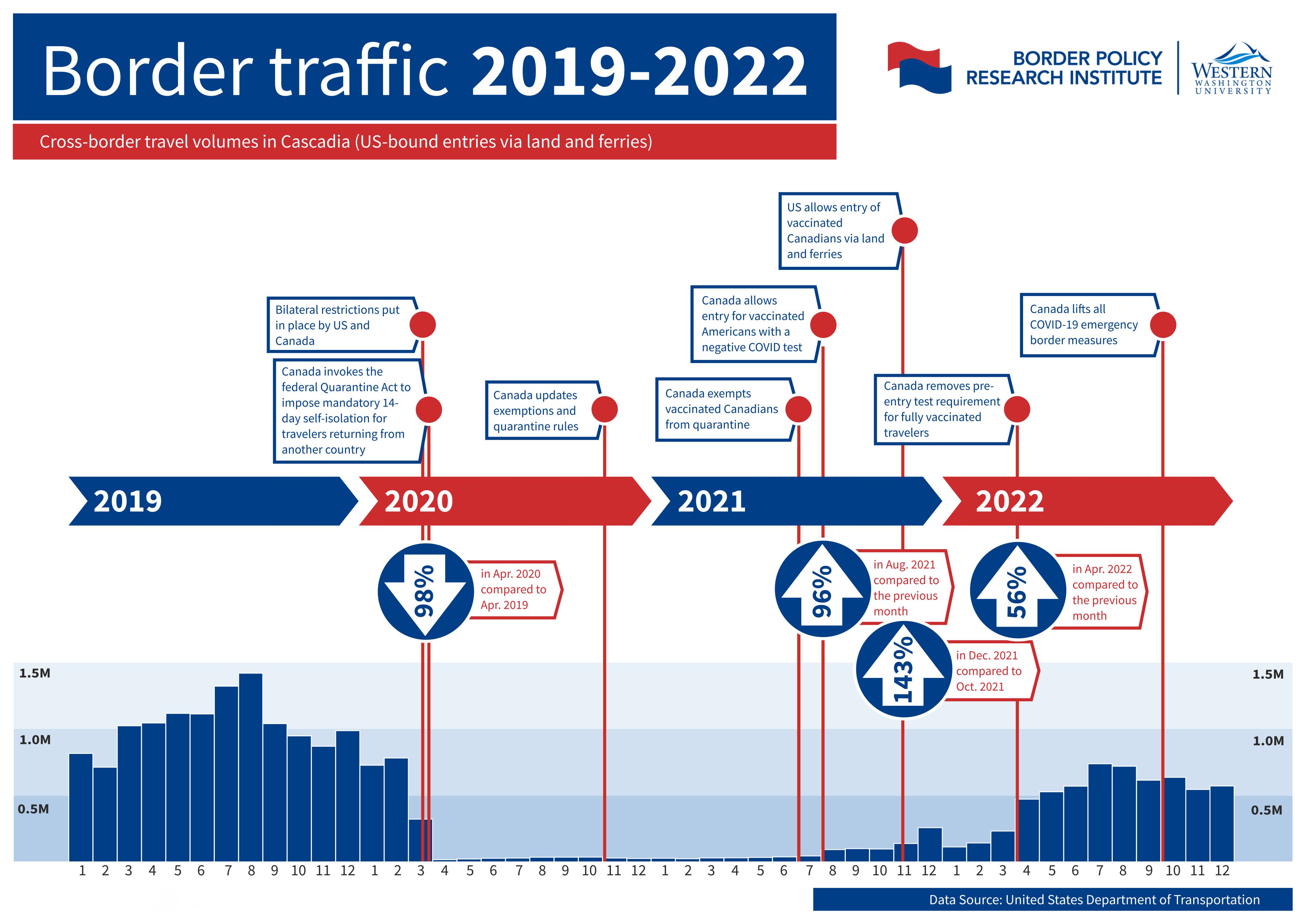
Cross-Border Travel Volumes in Cascadia. US-Bound Entries via land and ferries.
Download Infographic here.
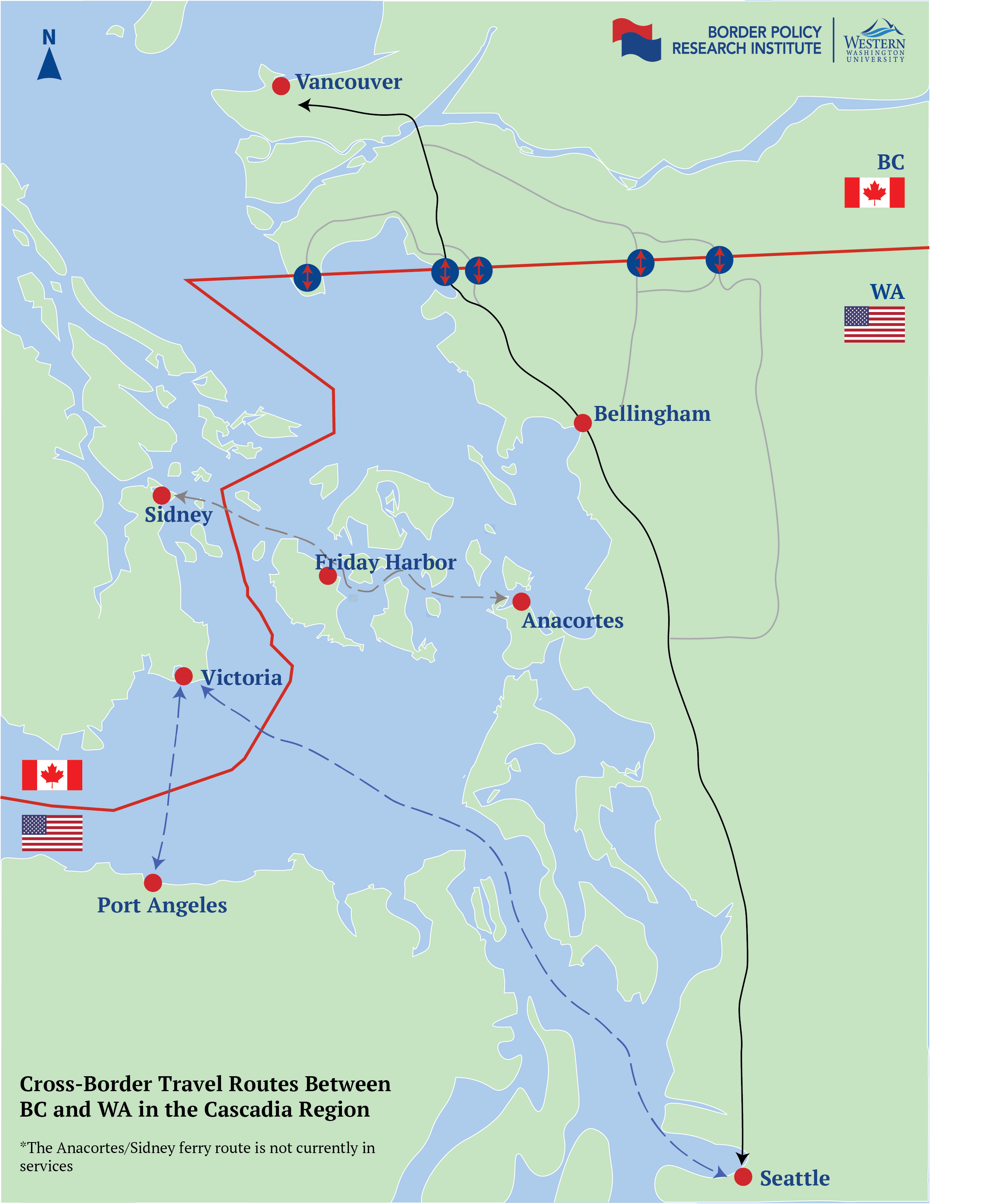
Cross-border transportation routes between BC and WA in the Cascadia region.
Download Map here.